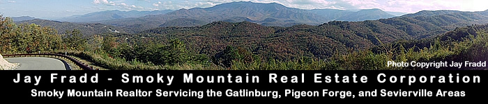
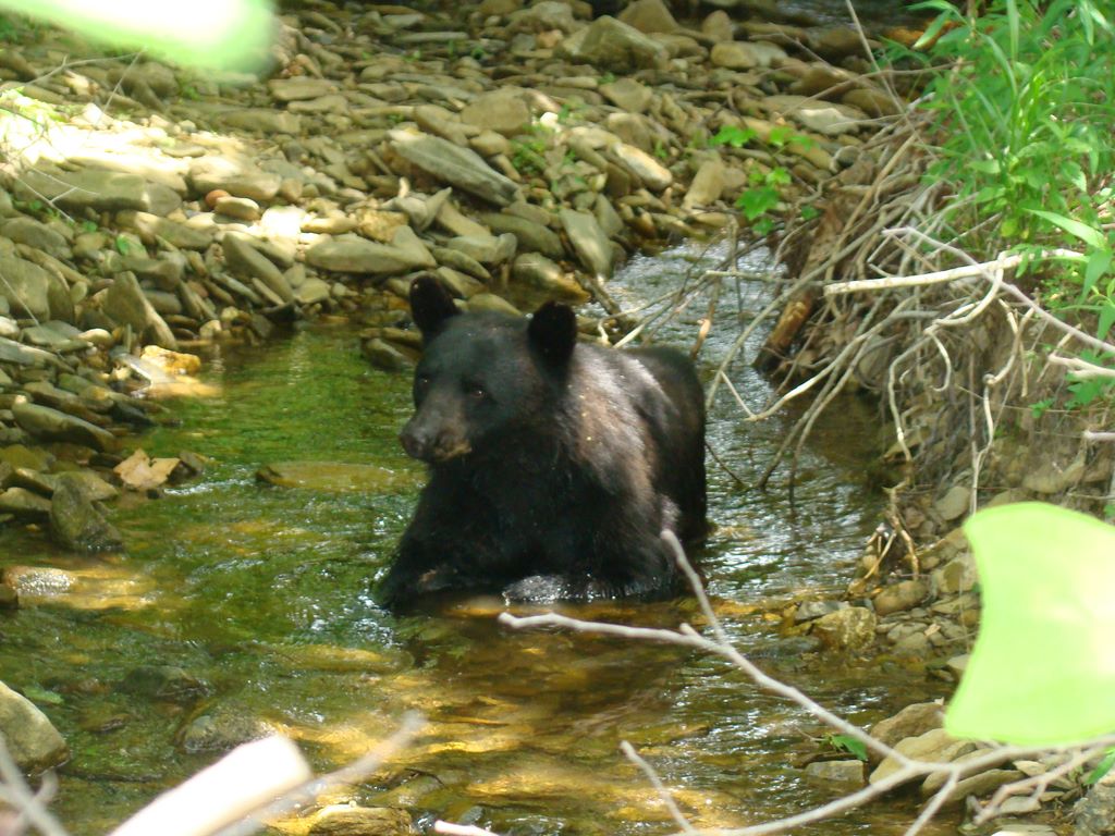
 Cades Cove is one of the best places in the Great Smoky Mountains National Park to see wildlife. While traveling the eleven mile loop, Jay has seen bears, deer, coyote, fox, and turkeys. The attraction to the 6,800 acre valley known as Cades Cove is not only the animals, but the picturesque scenery and old homesteads. During trips in the summer chances are fairly high you will see a bear and its cubs. Over several trips in the summer, Jay has seen bears up in trees, roaming in the pastures near Sparks Lane, bear cubs in creeks, and even several bears right next to the old Tipton Homestead. When driving the loop and there is wildlife ahead, traffic sometimes comes to a standstill. Usually this is a "bear-jam" as onlookers stop to take pictures and view with binoculars. The deer in the area are plentiful. It is common when driving the loop to see between 40 and 100 deer in the fields, pastures, and woods. The best time to see wildlife in Cades Cove is right after sunrise or a little prior to sunset. For the most part, drivers are courteous when driving the loop by pulling off to the side of the road, allowing other motorists to pass. The loop itself is a one-way road with a couple two way roads (Sparks Lane & Hyatt Lane) that cut from one end of the loop to the other should you want to exit.
 My wife, Brooke, and I enjoy Cades Cove so much that we got married at the Missionary Baptist Church in Cades Cove on November 8, 2008. We still travel into Cades Cove on a regular basis and enjoy bike riding on an early Saturday morning or driving through in search of wildlife.
View photos from our trip to Cades Cove July 4, 2009
To view a slideshow of pictures Jay has taken from Cades Cove including bear, deer, fox, turkey, many of the old cabin homesteads, and the scenery please click here.
Rich Mountain Road Views
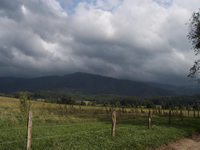
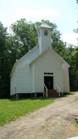
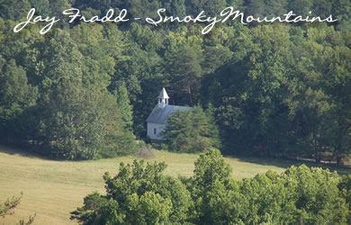
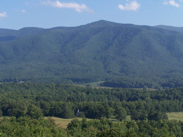 During your travels along the loop you will come upon Rich Mountain Rd. on your right (next to the Missionary Baptist Church). This road is a seven mile one way road that will take you into Townsend, TN. Please note this road is gravel with many switchback curves and takes quite a long time to travel - approximately one hour. Rich Mountain Road was built in the 1820s following an old Indian trace into Cades Cove. Points of interest include a stand of shagbark hickory, a species rarely found in the Smoky Mountains. One of the most popular location for photographs in the Smoky Mountains is from Rich Mountain Road. In the early travels on your right is a clearing where views can be seen of Thunderhead Mountain and the Primitive Baptist Church (see photo at left). Jay has also seen quite a bit of wildlife on this road including two bears, a fox, and coyote. Once you have driven past the view of the Primitive Baptist Church, there are not many views of interest as you make your way toward Townsend. This road is closed during the winter.
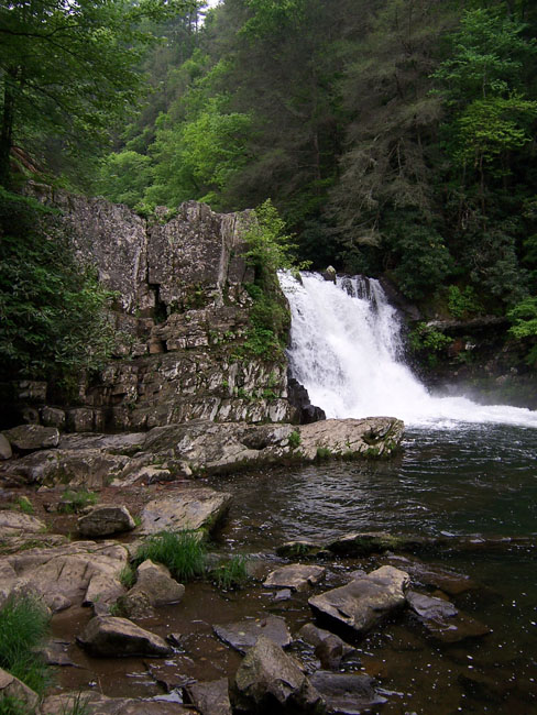
Abrams Falls
Abrams Falls is a 5 mile roundtrip hike of easy to moderate difficulty. The trailhead is located in the Cades Cove Loop. The falls is a wide falls about 20 foot tall plunging into a deep pool. This pool area is popular with swimmers in the summer and fisherman whenever people are not around. The hike is summarized well from another website:
 "This creek is named for Cherokee Chief Abram, who once lived on land now submerged under Lake Chilhowee, located on the western corner of the park. The trail starts by crossing a large footbridge over Abrams Creek. The stream here is a popular foot-cooler. To the right after the footbridge is a side trail to the Elijah Oliver house. Elijah Oliver was the son of the first white settler in Cades Cove in 1818, John Oliver. Another family dwelling, known as the John Oliver House, is the first house you see as you start the loop road.
The trail begins to climb gradually to reach a height above the stream, then turns a corner to the right and descends again to follow the river. The trail stays level for a considerable distance. In this stretch children frequently depart the trail to enjoy the water while their parents wait patiently. The trail then climbs toward a rocky point of Cades Sandstone at the top of Arbutus Ridge, and switches back to the right and descends again to Abrams Creek. It switches back again to the left over a side creek on a log bridge and curves right to follow the creek again for a flat stretch.
The trail then makes a final climb above Abrams Creek. It curves right at a point where you can hear the falls below you, then descends steeply to another log bridge over Wilson Branch. After crossing this bridge, the trail curves left to follow the creek on the other side. In a very short distance, another bridge appears to the left. Cross this bridge to follow the short spur trail to the 20-foot Abrams Falls. The pool at its base is 100 feet across and is a popular playground for children.
Be careful in the water at Abrams Falls because the rocks are extremely slippery, and it is easy enough to catch the edge of a rock in a fall. Parents should probably escort small children across the faster part of the stream (and the slicker rocks) to the shallow sand bar at the center of the pool."
Fishing in Cades Cove
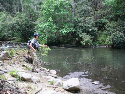 One of the best places in the entire Smoky Mountains National Park to fish is Abrams Creek which flows through Cades Cove. Access to the prime fishing portions of Abrams Creek can be reached via the Abrams Falls trailhead in Cades Cove or by taking the Foothills Parkway in Walland. The "horseshoe" bend in Abrams Creek is one of the most prolific areas for fishing in the Smokies. Jay has fished Abrams Creek by entering from both Cades Cove and from the Foothills Parkway. If you choose the Foothills Parkway portion it is a long hike to get to the trout waters. The trail for Abrams Falls leads away from Abrams Creek in a lot of places, so hiking through thick underbrush is necessary to gain access to Abrams Creek.
View Larger Map